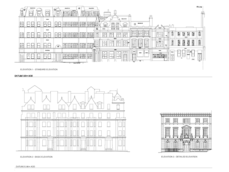
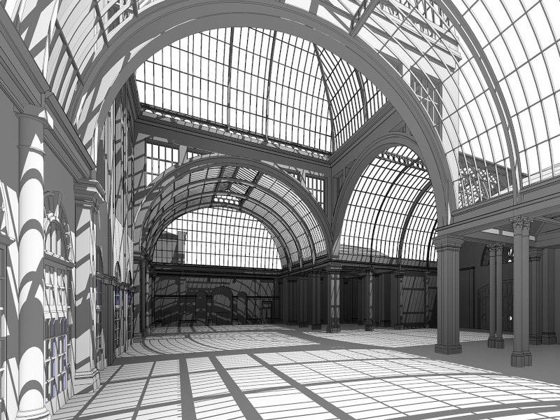
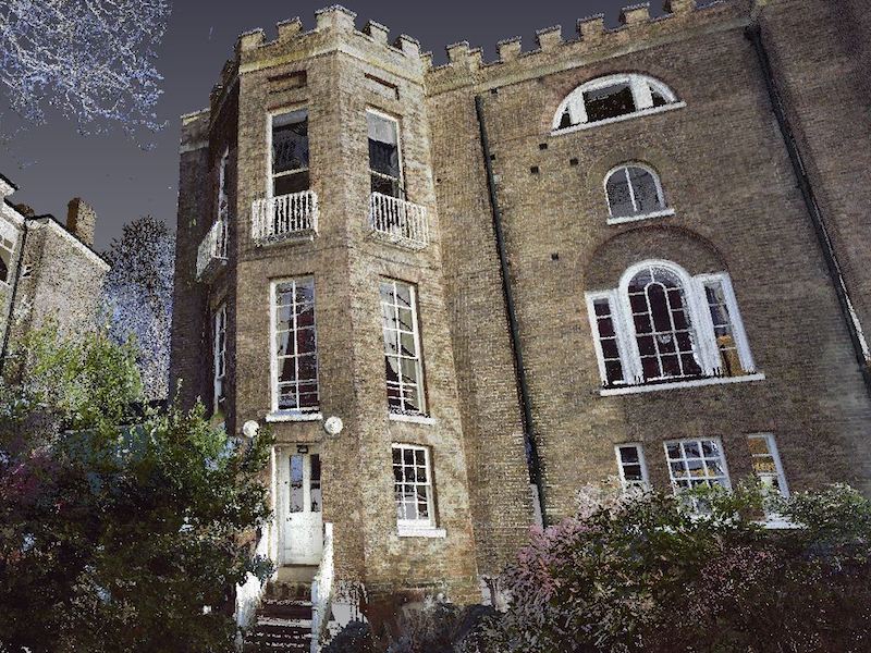
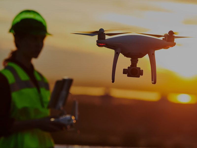
Maltby Surveys is a multidisciplinary Geomatics company which has developed since 1985 as a result of responding to the worldwide spatial data needs of its clients. It is a family-oriented business owned and managed by three of the Maltby brothers, Richard, Stephen and Andrew.

+44(0)1444 416246 contact@maltbysurveys.com

Archive

[vc_row][vc_column][vc_column_text] Drone Survey [/vc_column_text][vc_empty_space height="4px"][vc_column_text] Drone Surveys are becoming commonplace among the Geospatial Survey and Mapping Profession. Survey drones can generate high-resolution orthomosaics and detailed 3D models of areas where low-quality, outdated or even no data, are available. The technology required to carry out these surveys is becoming widely available and much more accessible. Caution must therefore be taken when appointing a survey company in a commercial context. Drone Pilots must be fully qualified, insured and with experience in carrying out this method of data capture safely and within the strict guidelines of the Civil Aviation Authority. Maltby Surveys offer this service employing 7 of our own professionally qualified CAA approved Drone Pilots. Clients can benefit from high-resolution imagery, 4k video recording or a full 3D point cloud generated using photogrammetric processing of the imagery. Not only is this solution suitable for high definition work, with respect to costs,

After more than five years in development Maltby Surveys have taken the next steps in their continuous journey to provide clients with the very latest in technological advances. With nearly all projects now being captured using FARO 3D Laser Scanners, clients can have the benefit of the rich information source that scanning provides. Now, with the ability to measure, collaborate and share information with the whole design team, there has never been a better time to commission Laser Scanning for your project.

[vc_row][vc_column][vc_column_text] Animations [/vc_column_text][vc_empty_space height="4px"][vc_column_text] All the above animations have been generated by our in-house modelling team, from either 3d Parametric or Solid Building models created by Maltby Surveys. The data used to build the models has been obtained exclusively using 3d Laser Scanning techniques and Drone imaging. Some of the animations demonstrate how fly throughs can be generated through the registered point cloud to give a true representation of the existing situation. This has the advantage of speed and is very low cost as it does not require any form of CAD Modelling. Other animations show the value of adding people or assets to the models to give a more realistic context. If you have commissioned either a Revit Model, 3d CAD Model or drone survey, please contact us via the contact page to discuss the possible animation options for your project. [/vc_column_text][/vc_column][/vc_row]

Maltby Surveys are specialists in the provision of water related surveying with more than 35 years’ experience. Commissioned by the Environment Agency, British Waterways, Water Utilities, OPW Ireland and numerous water consultancies, the company is considered one of the market leaders in this survey discipline. The company operate from four strategically based UK offices and is therefore able to mobilise rapidly and sustainably to any region to provide a local service to local clients.

Maltby Surveys has been undertaking Topographic and Planemetric Surveys for more than 35 years. During this period, they have been commissioned by a range of clients including Architects, Local Authorities, Engineering Consultants, Planners, Developers, Legal Professions, Project Managers, Utility Suppliers and Landscape Designers. Topographic Surveys are carried out for the purpose of conceptual design, infrastructure development together with a host of other requirements to aid the impending changes and proposals to the existing surface terrain. Combining large scale topographic mapping expertise with cutting edge measurement technologies Maltby Surveys are able to provide mapping solutions to clients’ needs. Surveys are presented at various scales, formats and perspectives to accommodate individual requirements. Using advanced Hardware and Software systems we can translate spatial data into digital and hardcopy formats.

Whilst there is a seismic shift to the 3D Environment when we talk about measured building surveys, frequently particularly on small scale projects the specification from clients often only requires 2D outputs. These outputs are generally presented as Floor Plans, Elevations and Sections to represent the building or structure being measured. Irrespective of whether a full BIM model or more traditional 2D deliverables are required, our method of data capture remains the same. From one-bedroom apartments to complex retail sites each and every project is now captured using 3D Terrestrial Laser Scanning.

Maltby Surveys is fully committed to providing efficiencies and cost savings while still delivering on quality. It was one of the first companies in Europe to invest in terrestrial 3D laser scanning technology and since 2001 has refined and developed workflows to ensure the most rapid and efficient data capture and processing, fully supporting the BIM process. For BIM to really succeed, it is vital that collaboration remains fundamental to the core of the process. Chartered Geomatics Professionals are at the foundation of that core and are widely recognized worldwide for their invaluable input to the spatial data requirement for virtually all construction related projects.

The process of collecting 3D coordinates of a given region of an object surface automatically and in a systematic pattern at a high rate of thousands of points per second, achieving the resulting 3D coordinates in near real time. To facilitate the production of measured Floor Plans, Sections and Elevations Maltby Surveys capture highly detailed 3D information about building structures of all types. We utilise the very latest “cutting edge” technology in the form of 3D high definition terrestrial laser scanners to collect vast amounts of point cloud data which are then processed into 2D drawings or 3D models. 

Maltby Surveys
Privacy Overview

This website uses cookies so that we can provide you with the best user experience possible. Cookie information is stored in your browser and performs functions such as recognising you when you return to our website and helping our team to understand which sections of the website you find most interesting and useful.